|
Problem 3 - Page 5 of 6 |
ID# C403005 |
Problem 3: Basic Freeway Sections
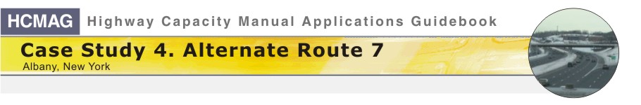
Exhibit 4-45
shows a view of Location E looking north taken from a location that
is about halfway through the weaving section at Location E. The sign to
Route 7 west can be seen at the right-hand edge of the picture. The bridge
immediately overhead is Route 7. The bridge in the background is the
semi-direct ramp leading from Route 7 westbound to I-787 southbound. The merge
sign in the distance at the left-hand edge of the picture is associated with
the location where the right-hand ramp from Route 7 west merges with I-787
north.
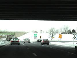
Exhibit 4-46 shows a view
looking east at Location L. The left-hand lane is the auxiliary lane that
goes from Location F on the western end to a point just beyond
Location L. To the left in the picture you can see the place where
the auxiliary lane rejoins Route 7 east. The right-hand lane is simultaneously
the end of the south-to-east loop ramp going from I-787 south to Route 7 east
and the beginning of the east-to-north loop ramp going from Route 7 east to
I-787 north. You can see the start of the east-to-north loop ramp in the
right-hand side of the picture. In the distance, you can see the spot where
the right-hand ramp from I-787 to Route 7 joins Route 7, which is also the start
of the weaving section at Location B.
 |
|
 |
|
Exhibit 4-45. View of I-787 North at Location E just
before the loop ramp diverges to go toward Route 7 west |
|
Exhibit 4-46. View of Route 7 at Location L looking east |
[
Back ] [ Continue ] with Problem 3