|
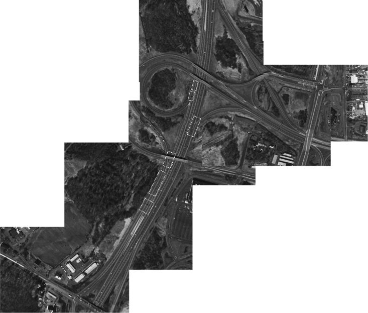
I-87/Alternate Route 7 Interchange (Note: Move the cursor over this aerial photograph to find hotspots that will allow you to see more detail of the interchange with a ground level photograph. The hotspots are highlighted by a dashed line rectangle in the figure below.) Starting at the top of the image and working south, we see the following things. First there are the exit ramps to Exits 6 and 7. The sliver of white is the gore that separates the two exit ramp lanes from the three main lanes. Next is the loop ramp to NYS-7 east. Then you can see the short single-lane connector that takes traffic going south to Exit 6 go from the diverge with the loop ramp to the merger with the semi-direct ramp. Starting at the southern end of the picture and working north, you can see Sparrowbush Road that crosses over the weaving section just north of Exit 6. Then you can see the point where the right-hand ramp diverges to NYS-7 east. To the right you can then see the interchange between NYS-7 and U.S. 9. On the south side of NYS-7 are the ramps to and from the eastbound direction. On the north side are the ramps to and from westbound direction. Also visible is the ramp short connector we described earlier that allows a connection from U.S. 9 to I-87 northbound. Click here to see an aerial photograph with key locations noted. |
 |